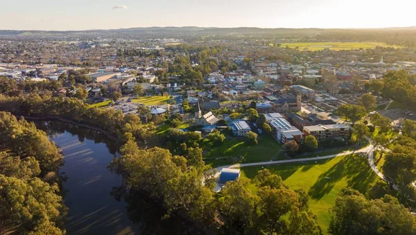
Wagga Wagga is the largest inland city in New South Wales, halfway between Sydney and Melbourne on the Murrumbidgee River. The 2650 postcode covers the CBD, the riverbend suburbs, and most of the urban footprint of a city of around 65,000 people.
ABS 2021 IRSAD release. Score 970 (national mean = 1000).
Decile 5 is a middle-of-the-pack reading and the IRSAD score of 970 sits below the national mean of 1000. State-percentile 45 places Wagga in the middle half of NSW postcodes, reflecting an income mix that runs from Charles Sturt University academic staff through to the RAAF Base Wagga and Kapooka Army Recruit Training Centre rotations. Three durable demand legs hold this market. Defence is the largest, with Kapooka cycling around 5,000 recruits through every year plus a permanent population of training staff and dependants. Charles Sturt University and the Joyes Hall research precinct anchor the student rental cohort. Agriculture and ag-services provide the third leg, with the surrounding Riverina being one of Australia's most productive food bowls. Wagga sits on the Hume corridor and is roughly equidistant from Sydney (5 hours by road), Melbourne (4 hours), and Canberra (3 hours). The inland location keeps growth volatility lower than the coastal regionals, and yields are typically meaningfully above the metro alternatives. This is a yield-strategy city not a growth one.
According to PRD Research's 1st Half 2026 market update, Wagga Wagga recorded a median house price of $705,000 in Q1 2026, representing annual growth of 11.9% from Q1 2025. yourinvestmentpropertymag.com.au reports 139 house sales in the 12 months to March 2026 with houses averaging 57 days on market, while PRD notes house sales volumes declined 16.7% year-on-year to 315 sales. propertyvalue.com.au records an average vendor discount of -5.3%, and PRD reports a vacancy rate of 1.0%, well below the 3.0% benchmark, indicating a tight rental market supporting price resilience.
Anchor points pulled per refresh from publicly available suburb profiles. Approximate; not a moving average.
Vacancy is tight at 1.0% and days on market are stable at 57 days, but vendor discounts have widened to -5.3%, producing a mixed signal that composites to steady.
Sources: Wagga Wagga Property Market Update 1st Half 2026 (2026-05-01); Wagga Wagga, NSW 2650: Suburb Profile & Property Report (2026-03-31); Wagga Wagga House Prices & Property Trends (2026-01-01); Wagga Wagga Property Market Update 2nd Half 2024 (2024-10-01); Wagga Wagga Property Market Trends & Insights (2025-07-01) · Refreshed 6 Oct 2026
Wagga Wagga's property story is currently being shaped by large scale growth area rezonings, road and freight infrastructure upgrades, and a persistently tight rental market. Council is progressing a major new residential zone in the city's south while state and federal governments fund highway, bridge and transmission works that support the wider Riverina economy, including the Bomen Special Activation Precinct. Rental vacancy remains very low, pointing to ongoing pressure on renters even as new dwelling supply is planned across northern and southern growth corridors.
Council has finalised a planning proposal to amend the Wagga Wagga Local Environmental Plan 2010 for the Southern Growth Area Zone 1, establishing a new community of roughly 2,900 dwellings supported by contributions-funded infrastructure, with an associated Development Control Plan now going on exhibition.
Summary of Council's 22 June 2026 Ordinary Meeting (2026-06-22)
A development application lodged for 5-9 Pearson Street proposes demolishing existing warehouses for a mixed retail, fast-food, light industry and childcare precinct, with Guzman Y Gomez among the confirmed tenants; the project has not yet been approved.
Retail, dining, and childcare in $17m development plan for prime Wagga site (2026-06-16)
A $30 million project is replacing Marshalls Creek Bridge and widening the Sturt Highway to four lanes at a known congestion pinch point used by about 21,000 vehicles a day, improving freight and commuter access into Wagga Wagga.
$30 million Wagga Wagga bridge replacement project progresses (2026-05-29)
Transgrid's HumeLink West project, a $1.5 billion transmission line linking Snowy 2.0 to the grid, includes an upgrade of the Wagga Wagga Substation and is now stringing conductor cables on towers near Gregadoo, part of broader regional energy infrastructure investment.
Stringing of HumeLink West transmission tower conductors begins (2026-07-02)
Council's 2025 Economic Snapshot names the Bomen Special Activation Precinct and the Riverina Intermodal Freight and Logistics Hub, alongside the Southern and Northern Growth Areas, as major investments strengthening Wagga Wagga's economic base, with Gross Regional Product up from $4.84 billion to $5.64 billion.
Economic Snapshot shows Wagga Wagga continues to thrive (2026-02-20)
Wagga Wagga recorded a vacancy rate of 1.0% in March 2026, with the wider LGA even lower at 0.6%, both well under the 3% benchmark for a balanced market, while the number of houses rented fell slightly over the year to Q1 2026.
Wagga Wagga Property Market Update 1st Half 2026 - PRD (2026-05-15)
Updated 4 Jul 2026. Items link to their original sources. Compiled by AI from public reporting; verify anything material before relying on it.
PropertyRanker scores any Australian property against 12 criteria across three pillars: Growth, Cashflow, and Risk. SEIFA is a primary signal for economic strength and a supporting one for entry-price risk. It also informs the crime side of hazard risk, though physical overlays like flood, bushfire and coastal exposure, and recorded crime data where available, take priority there. The decile of 5 shown above gives a listing in Wagga Wagga a broadly mid-band starting line on economic strength and entry-price risk relative to the national median postcode.
On top of that, PropertyRanker chooses one of four strategies (Balanced, Growth, Yield, Regional) and applies a per-strategy yield anchor. The anchors are 3.5% for Growth, 5% for Balanced, 6% for Yield, and 7% for Regional. A mid-band postcode does not favour one strategy outright; Balanced (5% anchor) is the common fit, with Yield (6%) reachable where a specific listing rent-to-price ratio supports it.
Read the scoring guide for the full criteria list and how the verdict thresholds work.
Wagga's 2650 postcode is geographically large and mixes very different micro-markets. CBD and East Wagga apartments cluster around the railway station and have a different demand profile to the detached-housing belt out toward Lake Albert and Bourkelands. The Murrumbidgee floodplain is the structural risk to verify. The 2012 flood put parts of Gumly Gumly, North Wagga, and lower-lying CBD streets under water, and the city has invested in levee upgrades since but the overlay still applies. Check the Wagga Wagga City Council Flood Risk Management Study for the specific lot, plus the SES historical flood mapping. Defence-rotation tenancy demand can be lumpy depending on recruit-intake cycles. Vacancy that looks tight average can soften after intake rotations. Charles Sturt rental demand is concentrated north of the river around Estella and Boorooma. CBD apartment supply has been measured through this cycle but check building age and strata fees if you're scoring one. Heritage overlays apply along Baylis Street and the old CBD grid.
The SEIFA IRSAD score of 970 sits below the national mean of 1000 and lands at the 45th percentile within NSW, which PropertyRanker reads as mid-band economic strength. That profile, combined with three durable demand legs in defence, university, and agriculture, points toward the High Yield or Regional strategies (gross-yield anchors around 6 to 7 percent) rather than Capital Growth. The inland location and income mix tend to compress price volatility alongside capital upside, so investors orienting around yield consistency are better aligned with what the data describes here than those chasing growth trajectories. Score the specific listing on PropertyRanker to see how a given property's entry price and estimated rent sit against those anchors.
Flood exposure is the most location-specific hazard to verify: the Murrumbidgee River has a well-documented history of flooding, and while the main city levee was upgraded to a 1-in-100-year protection standard as of 2020, low-lying and riverbend properties within 2650 carry meaningfully different risk profiles depending on their elevation relative to the levee. A mid SEIFA band also signals moderate entry-point risk, meaning the tenant pool is income-sensitive and vacancy can move with posting cycles at RAAF Base Wagga or Kapooka. PropertyRanker weights both hazard_risk and economic_strength using the SEIFA reading, so checking the per-listing score rather than treating all of 2650 as uniform is important.
Defence is the largest single demand driver, with Kapooka Army Recruit Training Centre cycling a large cohort of trainees and permanent training staff through the postcode continuously, and RAAF Base Wagga adding a second institutional tenant pool. Charles Sturt University and the Joyes Hall research precinct add a student rental cohort that tends to absorb smaller dwellings and share-house configurations. The practical effect is that vacancy can be structural and relatively stable, but it is also rotation-driven, meaning an investor should confirm current base population levels and university enrolment trends rather than relying on historical averages. PropertyRanker treats this multi-leg demand structure as a positive signal within its economic_strength criterion.
Wagga Wagga sits on the Main Southern rail line connecting Sydney and Melbourne, with NSW TrainLink XPT services running twice daily in each direction, and the city also sits at the intersection of the Sturt and Olympic Highways on the Hume corridor. Infrastructure connectivity of this kind is a qualitative input that supports the case for Regional strategy investment, since it reduces the isolation discount that can weigh on more remote inland postcodes. PropertyRanker's scoring does not directly price train frequency, but the connectivity context informs how the tool frames entry-point and hazard risk relative to other inland NSW postcodes. Investors should confirm that a specific property benefits from this access rather than assuming all of 2650 is equally connected.
PropertyRanker runs twelve scoring criteria across a listing; three of them draw directly on the SEIFA IRSAD reading for this postcode, which is a decile 5, raw score 970, placing Wagga in the mid band at the 45th state percentile. Those three criteria are economic_strength, hazard_risk, and entry_point_risk. The remaining criteria incorporate listing-level data such as the property's asking price, estimated rent, property type, and proximity signals, which is why two properties on different streets within 2650 can score differently. Scoring the specific listing rather than relying on suburb-level summaries is how PropertyRanker is designed to be used.
Paste a real address. Get a defensible verdict across 12 criteria in around three minutes.
Score a property free